


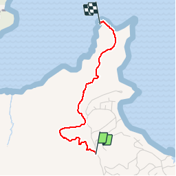
randonnée pointe banane

GabyG
User GUIDE

Length
3.1 km

Max alt
97 m

Uphill gradient
62 m
Km-Effort
4.2 km

Min alt
0 m

Downhill gradient
116 m
Boucle
No
Creation date :
2019-09-25 18:00:18.061
Updated on :
2019-09-25 19:29:19.222
1h25
Difficulty : Very easy

FREE GPS app for hiking
 SityTrail
IGN / Geographical institutes
SityTrail Plus
The world is yours!
About
Trail Walking of 3.1 km to be discovered at Martinique, Unknown, Le Robert. This trail is proposed by GabyG.
Description
de la pointe savane vers pointe banane
Photos


Positioning
Country:
France
Region :
Martinique
Department/Province :
Unknown
Municipality :
Le Robert
Location:
Unknown
Start:(Dec)
Start:(UTM)
724134 ; 1626139 (20P) N.
Comments